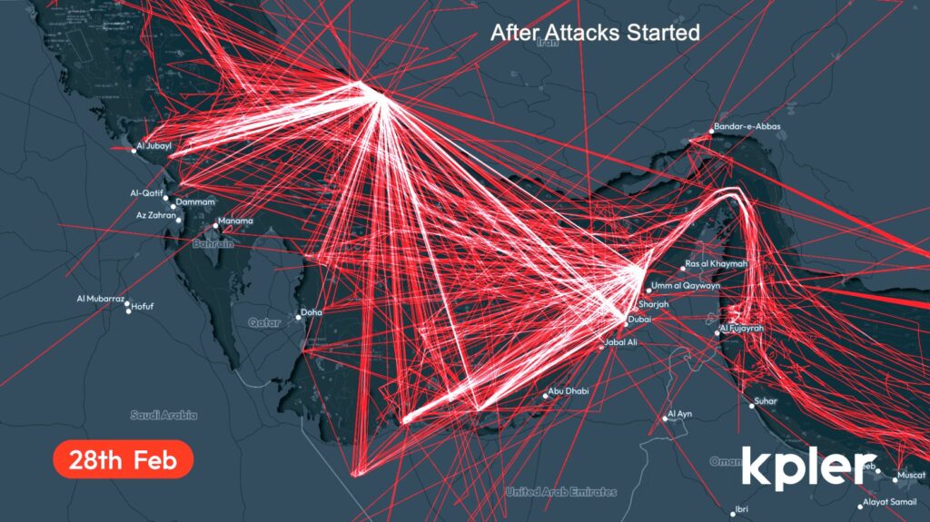
Bottlenecked ships anchored outside Straight of Hormuz. Ships travel the seas using the Automatic Identification System (AIS). It’s a satellite tracking system that uses transponders to continuously broadcast a ship’s location, type, length, and so on. Currently, over 210 tankers and container ships are anchored outside the Strait of Hormuz. Through this waterway choke point (Hormuz) flows 20% of the global oil, along with large volumes of LNG (Liquefied natural gas). The Strait is only 21 miles wide at its narrowest point. But the shipping lane width, in either direction, is only 2 miles. Those two lanes are separated by a 2-mile buffer zone. Massive AIS signal interference has been observed around the Strait of Hormuz and the Persian Gulf. This appears to come mostly…
Click here to read the full article at The Gateway Pundit.